Portcoast Earns Global Recognition on Esri’s Official Channel
Vietnam’s digital construction capabilities have gained global recognition after being prominently featured on the official YouTube channel of Esri, the U.S.-based global leader in Geographic Information Systems (GIS). In a video highlighting the future of the construction industry and digital transformation, nearly 80% of the real-world case studies presented—showcasing cutting-edge technological applications—are major infrastructure projects in Vietnam implemented by Portcoast. The fact that these projects were selected and showcased by Esri, the world’s leading GIS technology powerhouse, not only highlights the technological sophistication of Portcoast’s projects but also affirms Vietnam’s growing presence on the global map of digital infrastructure and smart construction.
What is astonishing is that up to 80% of the real-world application cases featured in the video, describing breakthrough technological achievements, are in fact major infrastructure projects in Vietnam, implemented by Portcoast and recognized by the technology "giant" Esri.
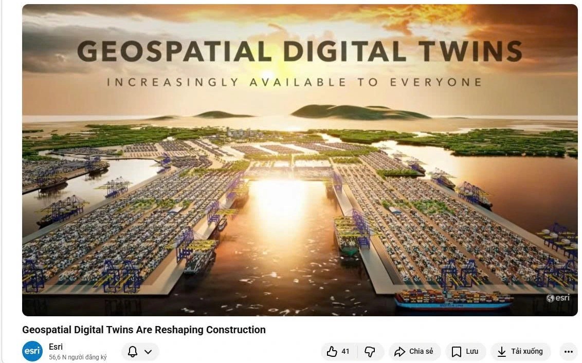
In the nearly 8-minute video titled "Geospatial digital twins are reshaping construction," Portcoast’s footprint is highlighted through key landmark projects in Vietnam
IMAGE FROM ESRI'S YOUTUBE CHANNEL
Portcoast is a leading joint-stock company in Vietnam specializing in port design consultancy, marine engineering, and digital transformation. Being featured on Esri’s official media channel is a significant recognition of the international capabilities of a Vietnamese enterprise.
In the video, Esri noted that Portcoast has mastered the "formula for success" in building and managing the lifecycle of a digital twin on a scale and depth they had never seen before. From integrating multi-source data on the ArcGIS platform to processing terabytes of imagery data, Portcoast has transformed 3D BIM-GIS models into "living entities" capable of real-time interaction.
It is not merely simulation, but future forecasting, and international experts have expressed surprise at Portcoast’s GeoAI application capabilities.
Below are presentation images from the video showing the strong presence of projects carried out by Portcoast, demonstrating the pioneering position of this Vietnamese enterprise:
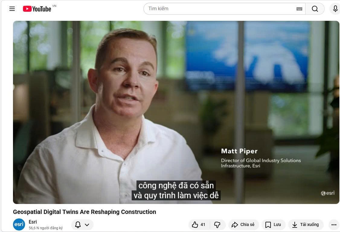
Mr. Matt Piper, Global Director of Industry Solutions Infrastructure at Esri, commented: "What impresses me about the work Portcoast is doing is that they have mastered the formula at a scale I have never seen before. With Esri’s GIS technology, they can manage the entire lifecycle of creating, managing, and maintaining digital twin models because they can integrate all these different datasets together through GIS"
IMAGE FROM ESRI'S YOUTUBE CHANNEL
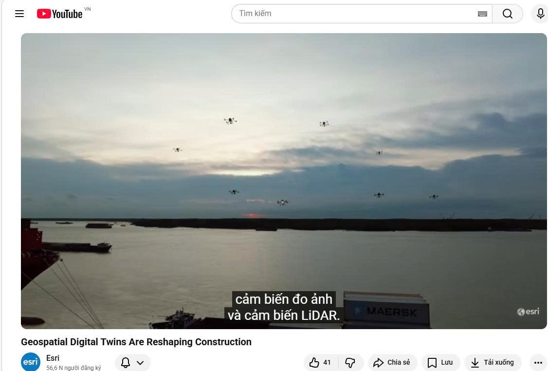
To collect data from existing site conditions, Portcoast uses a fleet of unmanned aerial vehicles equipped with photogrammetry and LiDAR sensors
IMAGE FROM ESRI'S YOUTUBE CHANNEL
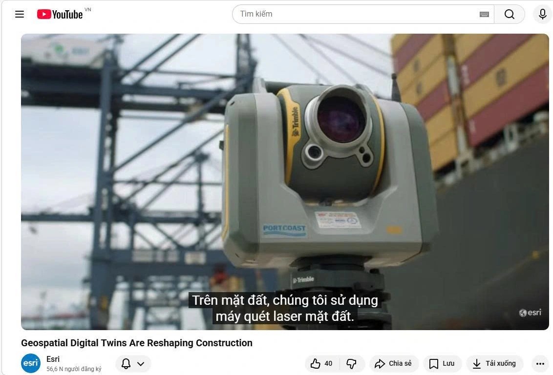
On the ground, Portcoast uses terrestrial laser scanners
IMAGE FROM ESRI'S YOUTUBE CHANNEL
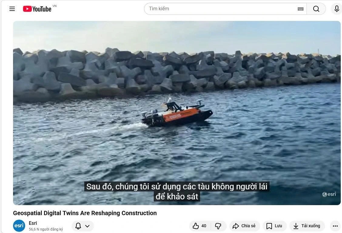
It then uses unmanned vessels to survey the seabed
IMAGE FROM ESRI'S YOUTUBE CHANNEL
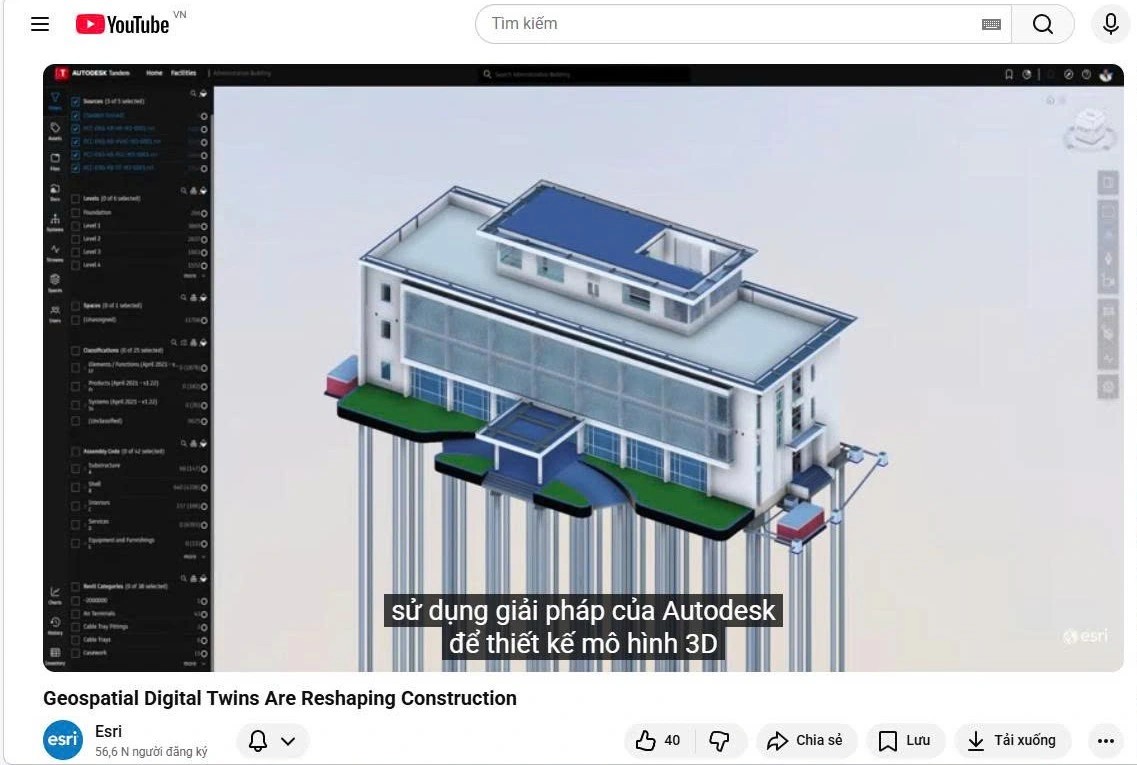
Using Autodesk solutions to design 3D models
IMAGE FROM ESRI'S YOUTUBE CHANNEL
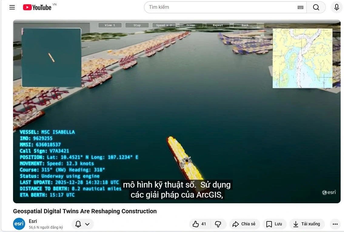
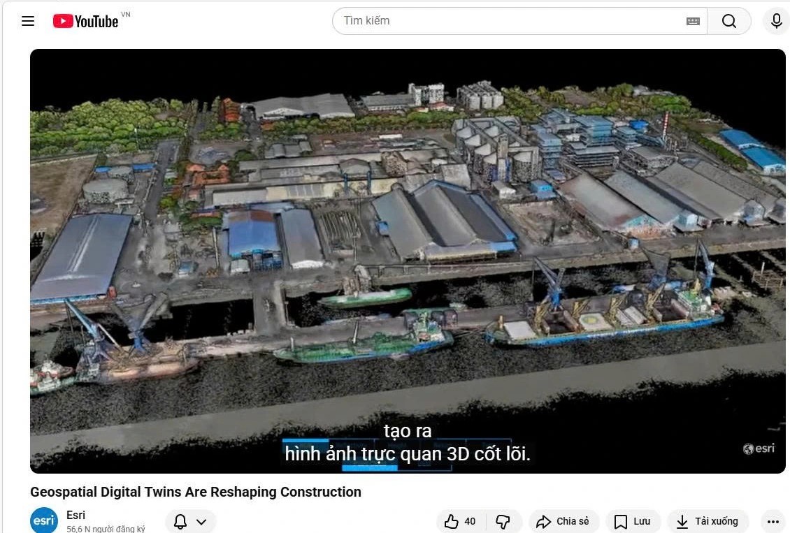
From data collected by devices and modern technologies, Portcoast creates digital twin models, enabling real-time monitoring of port operations
IMAGE FROM ESRI'S YOUTUBE CHANNEL
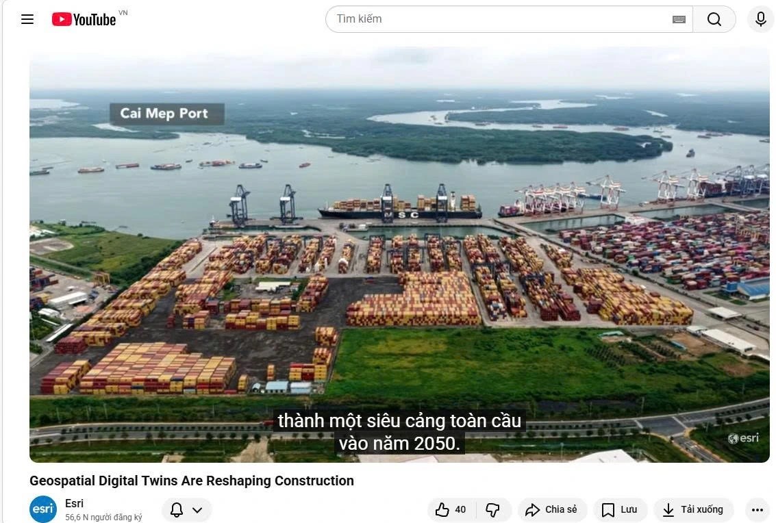
Mega-port complexes in the Ho Chi Minh City area (Cai Mep region) have been comprehensively digitized to optimize the construction and operation of port infrastructure
IMAGE FROM ESRI'S YOUTUBE CHANNEL
Complex facilities are modeled down to each structural component, supporting sustainable maintenance management in industrial parks and factories. Data integration helps track construction progress and enables precise decision-making directly on site for metro line projects and transport infrastructure projects
IMAGE FROM ESRI'S YOUTUBE CHANNEL
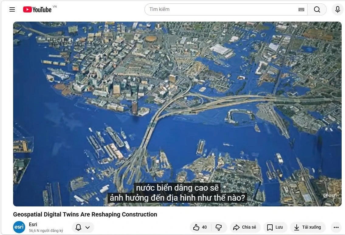
Projects carried out by Portcoast in Vietnam go beyond observation and also enable forecasting: from simulating collision scenarios to prevent accidents, to analyzing the impact of climate change and sea-level rise up to 2050 for sustainable construction planning
IMAGE FROM ESRI'S YOUTUBE CHANNEL
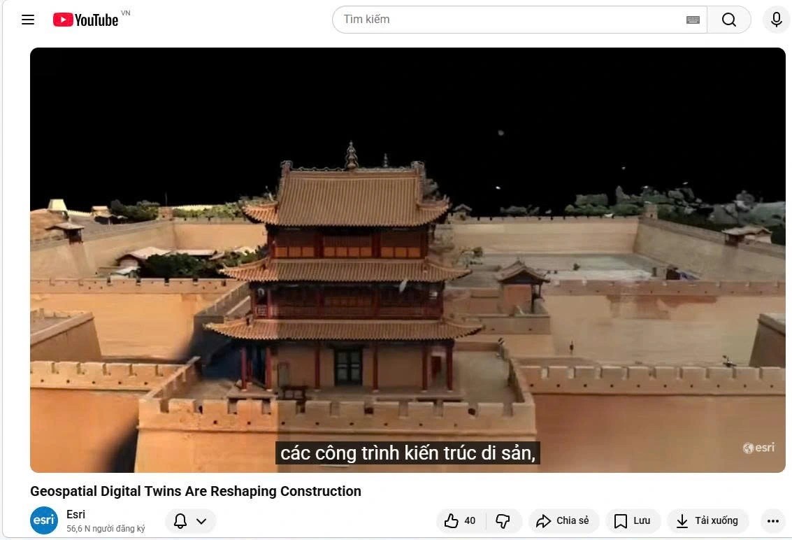
Portcoast has developed and continues to develop many digital twin models in multiple countries for other complex infrastructure assets such as factories, heritage architecture, inland waterways, and railway systems
IMAGE FROM ESRI'S YOUTUBE CHANNEL
Portcoast’s appearance as a representative example on Esri’s YouTube channel is not only a source of pride for Vietnam’s engineering sector, but also a confirmation of the company’s leading position in the race for digital twins and infrastructure digital transformation on the global technology map.
Source: thanhnien.vn
Pageviews: 0
Báo Thanh Niên đồng hành cùng Portcoast hơn 20 năm trên hành trình chuyển đổi số hạ tầng Việt Nam
Theo thanhnien.vn - 06/01/2026
Suốt hơn 20 năm qua, Báo Thanh Niên đã theo dõi, ghi nhận và lan tỏa h...
Portcoast và hành trình biến Cái Mép từ rừng ngập mặn thành cụm cảng nước sâu hàng đầu thế giới
Theo nhandan.vn - 22/12/2025
Hiện tại, Cái Mép là một cụm cảng nước sâu hiện đại, xếp thứ 32 thế gi...
Biến Dữ Liệu Thành Tầm Nhìn: Hành Trình Bản Sao Số Của Portcoast Cùng Esri
Theo www.esri.com - 22/12/2025
Biến Dữ Liệu Thành Tầm Nhìn: Hành Trình Bản Sao Số Của Portcoast Cùng ...